Agstafa Rayon (Aghstafa Rayon)
Aghstafa District (Ağstafa rayonu) is one of the 66 districts of Azerbaijan. It is located in the north-west of the country and belongs to the Gazakh-Tovuz Economic Region. The district borders the districts of Qazakh, Tovuz, as well as the Kakheti and Kvemo Kartli regions of Georgia. Its capital and largest city is Aghstafa. As of 2020, the district had a population of 88,500.
Aghstafa District was created on 24 January 1939 as an independent administrative unit out of the larger Qazakh region of Azerbaijan. On 4 December 1959, the status of the district was abolished and it was incorporated into Qazakh District. On 14 April 1990, by the decree of the Council of Deputies of Azerbaijan SSR, it was split from Qazakh District and was again re-established as a separate district. The regional center of the district is its capital Aghstafa. The district is located in the northwestern part of the country, between Qabirri basin and Lesser Caucasus mountain range, and Ganja-Gazakh lowlands and Ceyrançöl highlands. It is sandwiched by Qazakh District in the west and Tovuz District in east, and borders Armenia on the southern frontier and Georgia on the northern. The area of the district is 1,503.7 km2. There are 36 villages in the district. There are 39 secondary schools, lyceum, musical school, 2 museums, 38 cultural clubs, State Arts Gallery, 49 libraries, 3 city and 10 village hospitals functioning in the district. Ganja, Qazakh and Qarayazi lowlands make up the most of the district's area, whilst its southwestern and northeastern parts comprise lesser mountain sites.
Aghstafa District was created on 24 January 1939 as an independent administrative unit out of the larger Qazakh region of Azerbaijan. On 4 December 1959, the status of the district was abolished and it was incorporated into Qazakh District. On 14 April 1990, by the decree of the Council of Deputies of Azerbaijan SSR, it was split from Qazakh District and was again re-established as a separate district. The regional center of the district is its capital Aghstafa. The district is located in the northwestern part of the country, between Qabirri basin and Lesser Caucasus mountain range, and Ganja-Gazakh lowlands and Ceyrançöl highlands. It is sandwiched by Qazakh District in the west and Tovuz District in east, and borders Armenia on the southern frontier and Georgia on the northern. The area of the district is 1,503.7 km2. There are 36 villages in the district. There are 39 secondary schools, lyceum, musical school, 2 museums, 38 cultural clubs, State Arts Gallery, 49 libraries, 3 city and 10 village hospitals functioning in the district. Ganja, Qazakh and Qarayazi lowlands make up the most of the district's area, whilst its southwestern and northeastern parts comprise lesser mountain sites.
Map - Agstafa Rayon (Aghstafa Rayon)
Map
Country - Azerbaijan
 |
 |
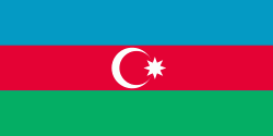
| Flag of Azerbaijan | |
The Azerbaijan Democratic Republic proclaimed its independence from the Transcaucasian Democratic Federative Republic in 1918 and became the first secular democratic Muslim-majority state. In 1920, the country was incorporated into the Soviet Union as the Azerbaijan SSR. The modern Republic of Azerbaijan proclaimed its independence on 30 August 1991, shortly before the dissolution of the Soviet Union in the same year. In September 1991, the ethnic Armenian majority of the Nagorno-Karabakh region formed the self-proclaimed Republic of Artsakh. The region and seven surrounding districts are internationally recognized as part of Azerbaijan pending a solution to the status of the Nagorno-Karabakh through negotiations facilitated by the OSCE, although became de facto independent with the end of the First Nagorno-Karabakh War in 1994. Following the Second Nagorno-Karabakh War in 2020, the seven districts and parts of Nagorno-Karabakh were returned to Azerbaijani control.
Currency / Language
| ISO | Currency | Symbol | Significant figures |
|---|---|---|---|
| AZN | Azerbaijani manat | ₼ | 2 |
| ISO | Language |
|---|---|
| HY | Armenian language |
| AZ | Azerbaijani language |
| RU | Russian language |


